

Transportation Asset Management Software (TAMS)
DEPRECATED
This software is no longer supported. Please use the newer versions of our software.
Tams v2 & v3 Status
Tams v2 & v3 are now available free of charge to everyone. (Previously it was free only for Utah cities and towns.) Due to the age of the currently available versions of TAMS, we're making both available. There is no support for these versions; except to Utah cities and towns.
About
TAMS was developed by the Utah LTAP to assist local agencies in Utah to maintain, preserve, and enhance their road and street facilities. Currently, many state and local transportation agencies use this tool to cost effectively preserve, and improve their infrastructure network.
The TAMS program is uses a Geographic Information System (GIS) interface, Map Window, and allows the user to point and click on a map to select individual transportation asset features such as street segments or signs for inventory, condition rating, analysis, and treatment tracking purposes. Although a GIS map is not required for most functions of the program, it is highly recommended.
Screenshots
These screenshots will give you some idea of the functionality of TAMS
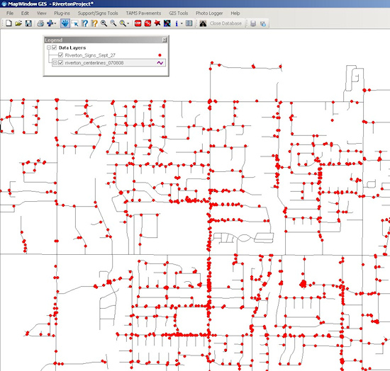
map view with Safety Software Suite "signs" plugin
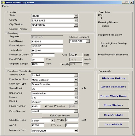
The asset inventory form is accessed by point and click via the GIS interface. Physical attributes as well as pavement distress ratings are recorded here.
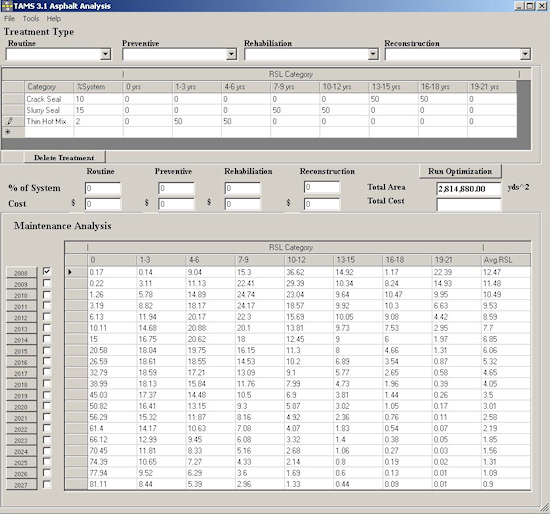
The Analysis/Maintenance Optimization Tool allows the user to design a maintenance strategy by appling virtual treatments to all or part of the system and view the resulting effects. Results show money spent, area treated and increased remaining service levels (RSL).
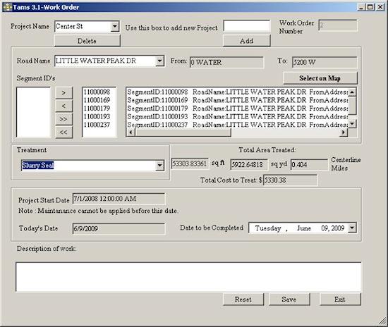
The TAMS Work Order form is project based. The user can add multiple street segments to a project by street name from a drop down menu or by clicking the segment from the map. Once the desired treatment is selected, the user can immediately see the total area to treat and the cost.
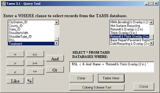
The TAMS Query Tool allows the user to write custom queries and then export to a text file or MS Excel sheet or color the resulting street segments on the map.
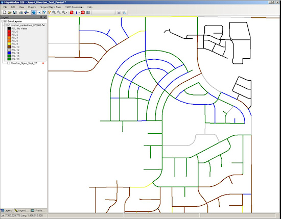
The TAMS Color Scheme Tool is designed to create maps by coloring street segments according to the specified criteria. For example, a Pubilc Works Director may want to see a map of the recommended treatments and have each treatment denoted by a separate color. In this case, the color GREEN could mean slurry seal, the color BLUE could mean crack seal, and the color BROWN could mean overlay.